
No matter where you are, there must have been a time or there must be some aspirations right now, to travel the world. A few years ago, this process involved planning, booking tickets and going on an adventure. But now, with the world fighting a pandemic, travelling has become a little more tricky and in some cases, a bigger hassle than anything else. Wouldn’t it be nice if there was some way to actually travel to your favourite place in the world, without really getting off your bed?
The first thought that may come to mind is Google Maps or Apple Maps. The map software has undergone so much evolution that you can now have a virtual tour of your favourite place, right inside your smartphone or PC, and the best part is, it doesn’t even cost a penny!!
But these mapping software have their limitations, and most of the time, the experience is not really as immersive as you may want it to be.
That is where the real solution comes into play, and that is none other than Google Earth.
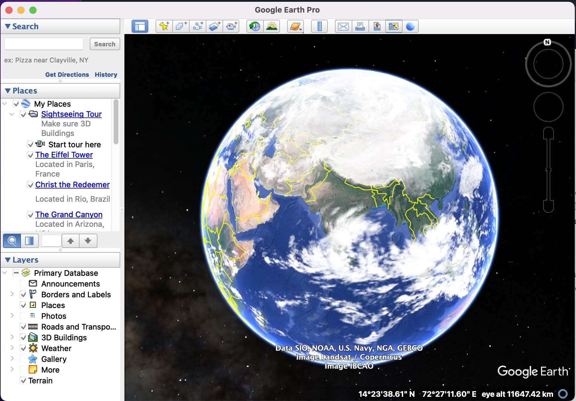
Google Earth, for those of you who don’t know, is the three-dimensional planetary browser that shows our entire planet (albeit a few top-secret military bases) in satellite imagery and aerial photos.
This has been in the works for a while now, and people have absolutely put this software on a different level, as it allows them to literally explore a virtual 3D earth, and all the places it contains, anytime and anywhere you want.
Google has been collaborating with satellites, on-ground support and individual contributors to supply high quality images of locations all around the world, and every month, a list of locations are upgraded to reflect any new changes that may have taken place, in terms of terrain or establishment of new buildings or spots of interest. This list of locations is pre-decided by Google, so there is no point holding out hope for your hometown getting an upgrade as it will only get the change when Google receives significant footage that reflects changes to that location.
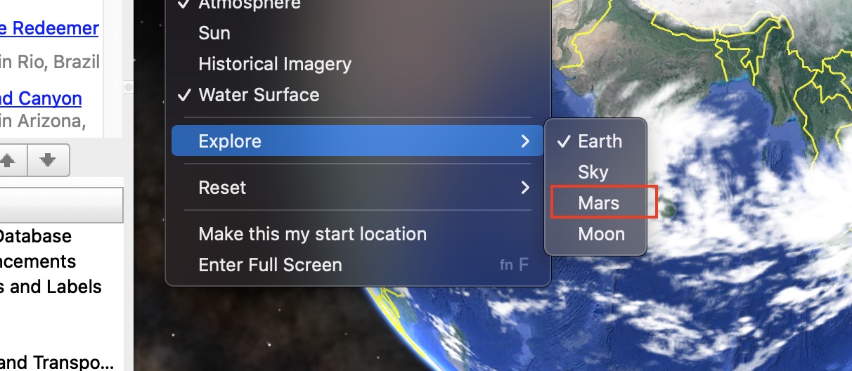
Now, what is incredible is that along with showing you a virtual Earth, the software also allows you to navigate a virtual Mars. Yes, you read correctly, you can now take a virtual tour of Mars and see all the sites that have been catalogued by the rovers that are or have been on the planet for research and mapping purposes. So, if you want to take virtual space tour, this is how you can do it –
Step 1. Open the Google Earth Pro software on your computer.
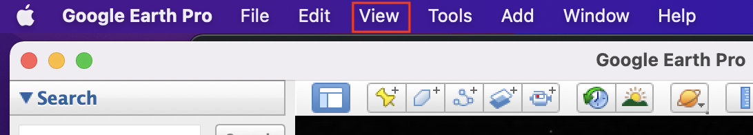
Step 2. From the menu bar, click on the ‘View’ button.
Step 3. Scroll through the drop down menu and hover over the ‘Explore’ option.
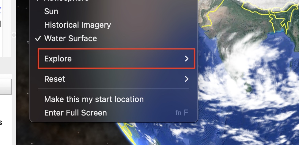
Step 4. Click on the ‘Mars’ option from the list that shows up.
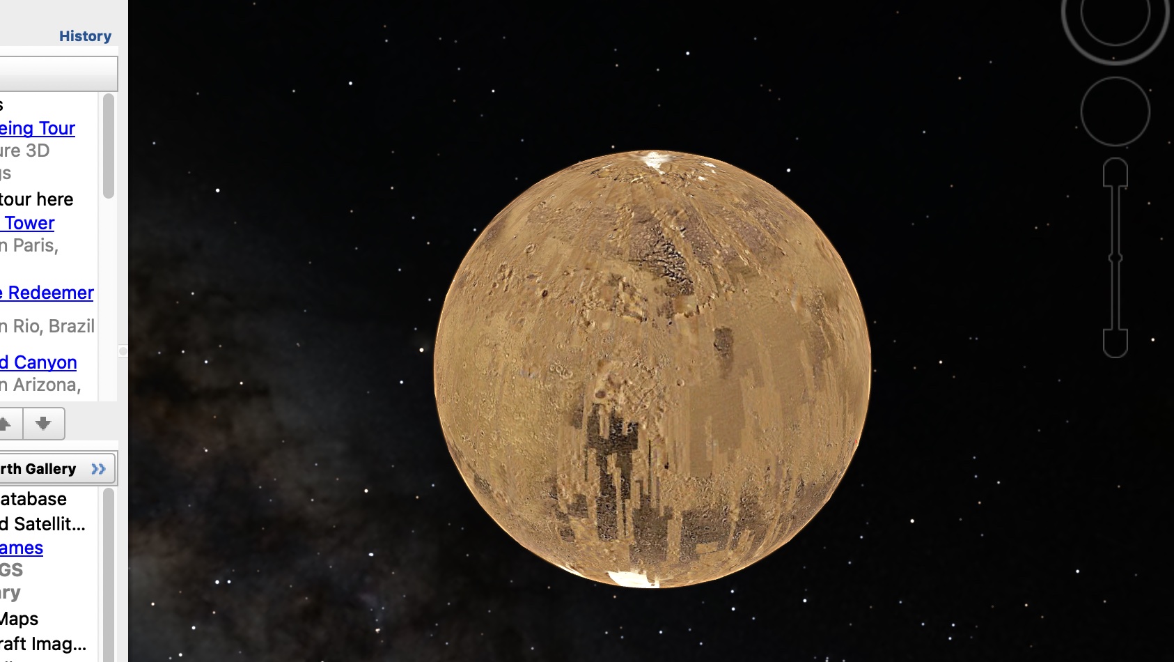
The virtual Earth will now be replaced by a virtual Mars with pins indicating all the places that have been discovered and mapped over the years. You can interact with the virtual Mars planet just like you would the virtual Earth.
You can download and run Google Earth on your system using this link.
So, go ahead, explore the world, without getting off your sofa!!
