
Are you someone who loves to travel, explore new places or maybe just curious about the distance between two locations? Well, Google Maps has become the go-to tool for many of us when it comes to navigation and location services. But did you know that it’s not just limited to finding directions? With Google Maps, you can measure the distance between any two points on the map, and it’s easier than you might think! Whether you’re planning a road trip, a hiking expedition or just curious about the distance between two places, knowing how to measure distance on Google Maps can come in handy. In this blog post, we’ll show you how to measure the distance between any two places using Google Maps like a pro!
Without further ado, let’s get right into it –
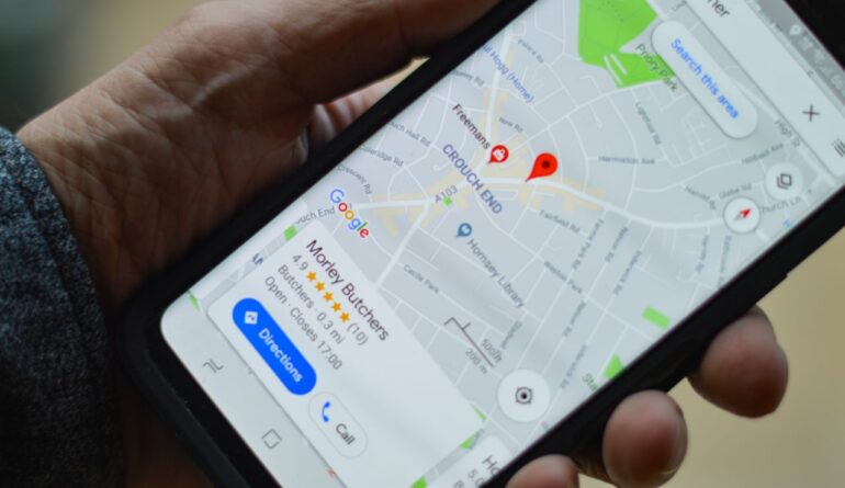
For Google Maps on the mobile
Google Maps is the most widely used map application on the mobile devices today, and surprisingly enough, the measure feature is available but as they say, it is hidden in plain sight. It only makes sense that we cover this platform first before moving to the PC version. Let’s go –
Step 1. Open the Google Maps application on your smartphone (Android or iOS). Since we are using an iOS device as our daily driver, this section of the tutorial will be done from the iOS point of view, but the application is quite consistent across both iOS and Android, so the steps will be identical.
Step 2. To place a pin on the map, simply tap and hold your finger on the desired location. This will become the first point or the start point of your measurement.
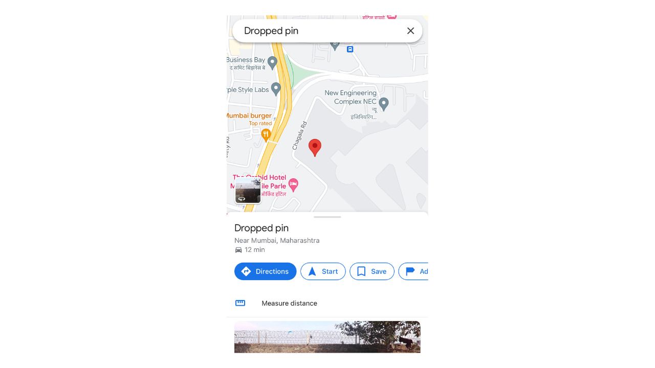
Step 3. Once, the point has been placed and your see the red indicator, a menu will appear and there, you will see an option that reads ‘measure distance’. Tap on it.
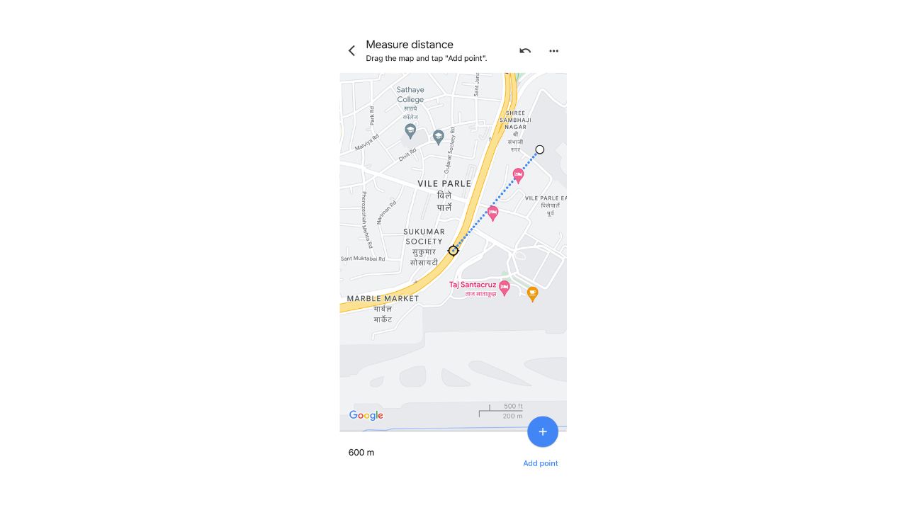
Step 4. Once you tap on the measure distance option, you will that a crosshair will appear on the map, that starts from the first point, and you can drag this crosshair to the final destination that you have in mind, and as you drag the crosshair, you will see the distance between the two points update itself in real time. Once you have reached the destination of your choice, the distance between the two points will be displayed at the bottom of the screen.
For Google Maps on the Web
On the web version of Google Maps, the measure distance feature is available but not really clear to see to the naked eye, but this tutorial will make things super easy!!
Step 1. Open the browser version of Google Maps on your computer.
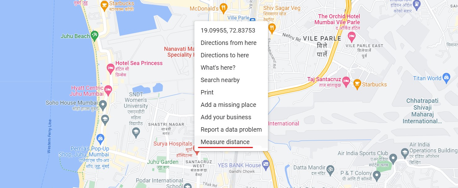
Step 2. Now, Right-Click on the point on the map from where you want to measure the distance between the two places. A drop-down menu will appear.
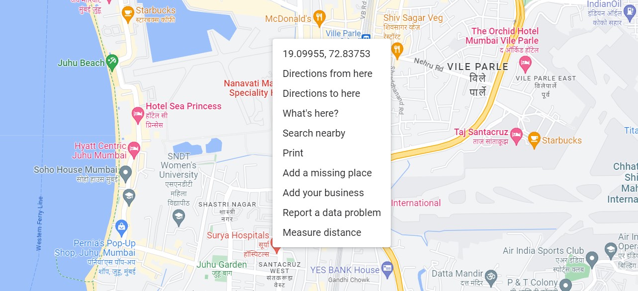
Step 3. In the menu, click on the ‘Measure Distance’ option.
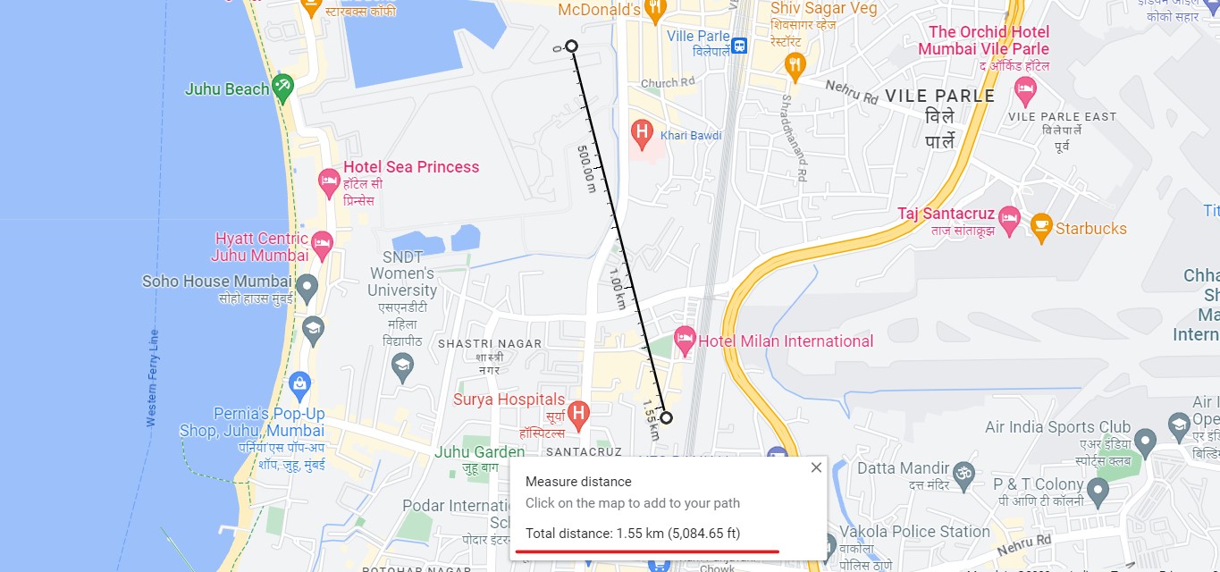
Step 4. Now, just click on the second point on the map, and instantly, the distance between the two points will be displayed.
In conclusion, while the distance measuring tool in Google Maps may not be the most efficient option for planning a trip, it still has a range of practical applications. Now that you know how to measure distance on Google Maps, you may find yourself using it more frequently for everyday tasks. Whether you’re measuring the distance between two points for a DIY project or trying to estimate the length of your daily running route, Google Maps has got you covered. So go ahead, give it a try, and see how this handy tool can simplify your life.
