
Step 3. From the search results, click on the one that is most relevant.
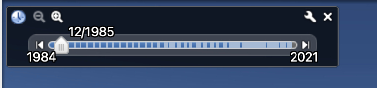
You will now see the globe orient to the location and it will slightly zoom in on the spot as well. Now, from the toolbar, click on the ‘Show Historical Imagery’ button. This will reveal a slider that will let you adjust how forward or backward in time that you want to go. For some places, this slider will go as far back as 1945, which is truly insane and is a testament to how Google has been religiously building this application to give us a glimpse of how things were in the past, as well as allowing us to compare how the same location has changed over time till we reach the present time settings.