
Google released Thursday a new dataset that depicts features on the Earth’s surface in near real-time. Dynamic World is a program that utilizes deep learning and satellite photos to create a high-resolution land cover map that reveals whether areas of land have features such as trees, crops, or water.
Land cover maps often take a long time to create, and there are significant gaps between the time photographs are captured and the data is published. They also frequently lack a precise breakdown of what’s on the ground in a given area — for example, a city would be classed as “built-up” (a category for human-altered landscapes) even if there are large portions with parks.
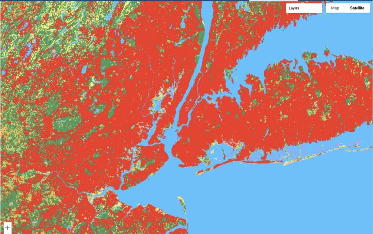
According to Google, Dynamic World assesses the land cover type for every 1,100 square feet. It indicates the likelihood that the portions are covered by one of nine different types of cover: water, flooded vegetation, built-up areas, trees, crops, bare land, grass, shrub/scrub, and snow/ice. Google described its approach, which is created in collaboration with the World Resources Institute, in a report published in Nature Scientific Data.
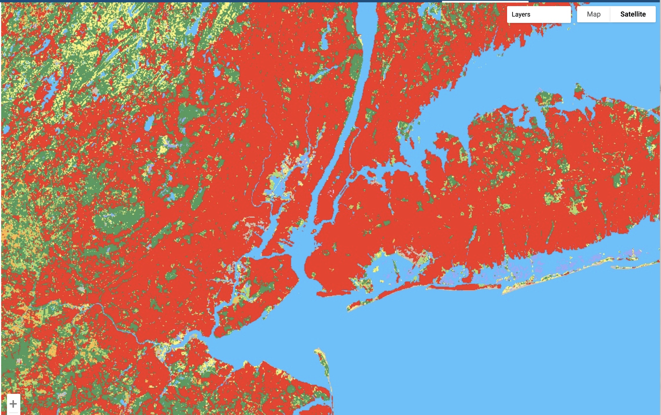
The above image of New York City, for example, indicates that the majority of the area is densely populated (red). However, the city’s major parks have areas of grass (green) and shrub/scrub (yellow).
The Dynamic World model generates around 5,000 photos every day, and the land cover data is updated in real-time. This allows academics and politicians to swiftly assess the effects of events such as wildfires or storms and better respond to changes.
