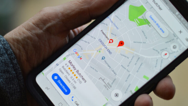

Driving or walking in crowded conditions reveals where basic navigation falls short. Traditional GPS displays an arrow moving along a line while you drive. It rarely tells you how long you will sit in a queue at a busy junction or whether you are likely to miss your pickup because of congestion. A navigation service that only plots a route without context will fail when uncertainty rises. Google Maps is adding four new features that confront these problems directly.
The first problem is predicting delays that are not simple traffic slowdowns. When large numbers of vehicles converge on constrained infrastructure like toll booths, bridges, or event access points, average speed loses meaning. A typical traffic layer reports speed or congestion level. It cannot quantify how long you will wait at a specific chokepoint because that depends on flow rate and stop durations. The new wait time estimates aim to fill this gap by providing expected hold times at these critical spots.
Providing a wait time estimate means analyzing past and real time data together. Historical traffic patterns shape expectations under normal conditions. Real time speeds reveal when conditions deviate. But the real challenge is isolating those specific locations where waiting is the dominant driver of delay. This requires identifying patterns that distinguish a simple slowdown from a queue. If the system conflates the two, its predictions fail. By targeting wait times at known bottlenecks Google Maps reduces uncertainty about when you will actually resume movement.
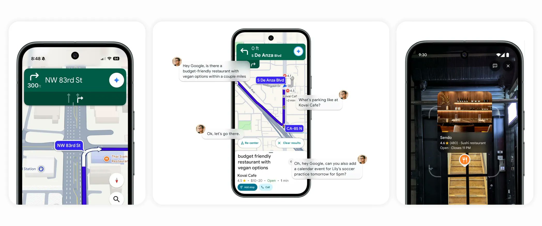
Another common problem for drivers and passengers is knowing exactly where and when a ride service vehicle will arrive. Traditional arrival time estimates treat the pickup point as a static coordinate. In crowded conditions, that is inadequate. Vehicles circle blocks, approach from different directions, and start movement only after confirming passenger visibility. This variability cannot be captured solely by distance and average speed. The new feature that updates vehicle arrival within the app tackles this by linking more precise location feeds from drivers or algorithms to the passenger view.
This reduces one type of delay that arises when a rider and driver lose synchronization. Without up to the second position data, passengers may step out too early or too late, which costs time and increases wasted idle mileage for drivers. Integrating real time vehicle trace data tightens the feedback loop between rider and driver so both sides know exactly when and how to connect.
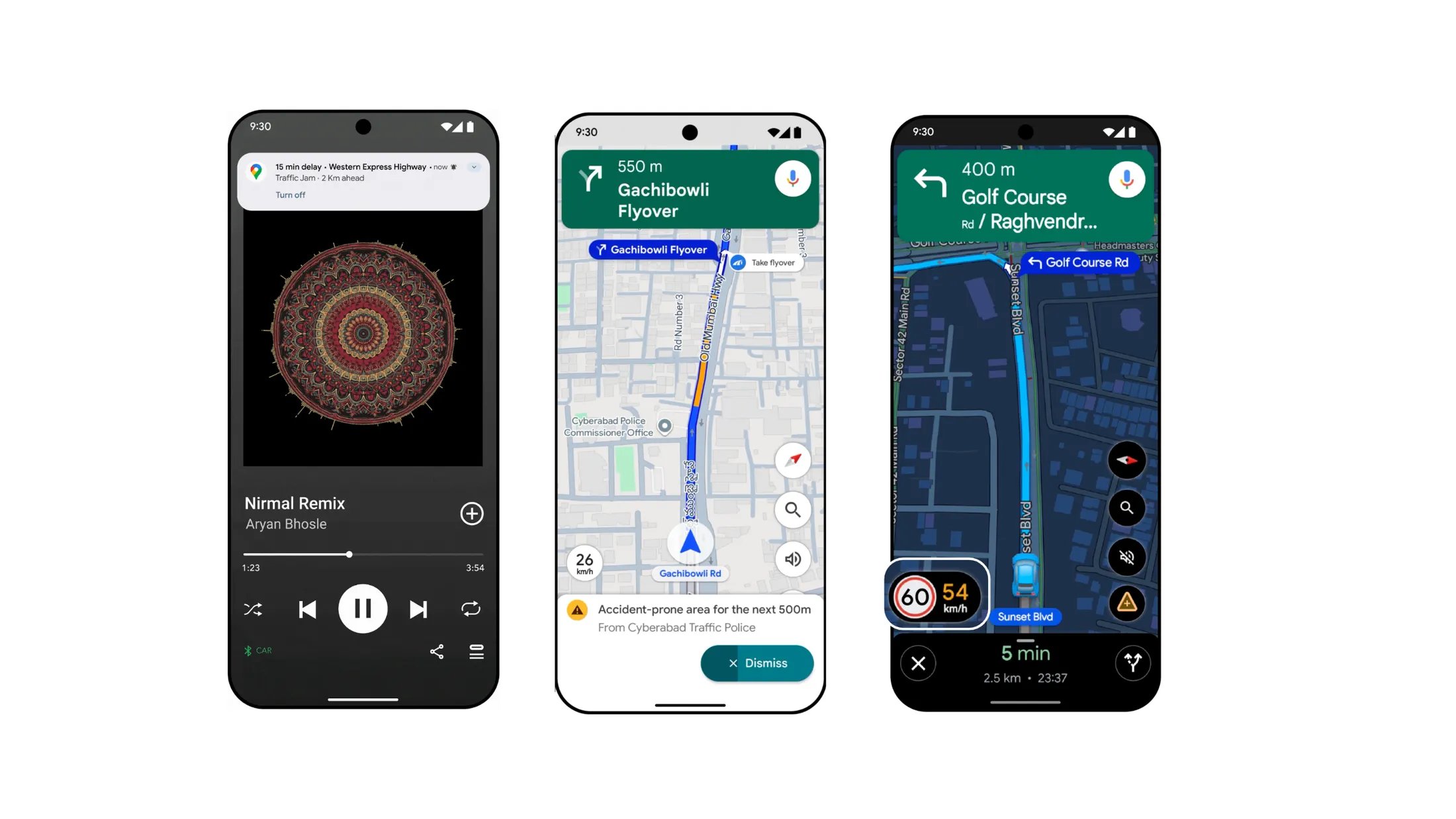
A different problem appears when a route branches or has many intermediate steps. Traditional maps show a line with arrows and icons for turns. This works well in low density areas with few choices. In complex urban grids or holiday detours it becomes hard to judge which lane leads where. Clarity matters because a wrong choice an exit, a fork, or a ramp can cost minutes. The improved route clarity feature focuses on making these junctions visually distinct.
To deliver clarity, the system must simplify what is most relevant and hide what is not. This requires understanding which parts of a junction cause decision points for drivers. Not every road marking or side street matters. Prioritizing the paths that carry the main route and the ones that lead away from it reduces cognitive load. Drivers can then focus on the next move rather than parsing a cluttered display. Simplification without loss of necessary detail is a balancing act.
Parking poses its own set of problems during peak travel. Large lots, structures with multiple levels, and crowded urban streets make it hard to judge where parking spaces are likely. Traditional maps might show a parking area icon but do not indicate the quality of availability within it. The new parking zone feature groups spaces into zones with suggested likelihoods of finding a spot.
To make a zone useful, the underlying system must aggregate data from multiple sources. Real time information from users, historical patterns, and even business reported availability feed into an estimate. Zones with high probability of space reduce time spent circling and unnecessary emissions. The feature also guides drivers to park closer to their destination within the constraints of expected availability.
Each of these features addresses a specific failure mode of classical navigation. Static arrival times become useless when traffic patterns fluctuate. Simple route lines break down in complex intersections. Parking icons mean little when spaces are scarce. Wait times become the dominant factor in total trip time when networks are saturated. By targeting these problems individually, the product reduces uncertainty in travel planning and execution.
These enhancements also reflect how user behavior changes under stress. During holiday travel people make more decisions under pressure with less tolerance for surprises. They accept guidance that reduces risk or time at each step. Navigation systems that provide more granular and relevant information reduce the need for reactive adjustments like last minute reroutes or sudden lane changes.
A technical constraint here lies in data variability. Predicting wait times requires enough historical data so that patterns are statistically reliable. For new or rarely congested bottlenecks, the estimates may be noisy. Arrival predictions for ride services need consistent and accurate feeds from moving vehicles. Without broad participation from drivers or robust telematics, the timing may drift.
Route clarity improvements depend on rendering that is fast and responsive. If the map redraws slowly or lags behind vehicle motion, drivers will mistrust the guidance and revert to simpler cues. Parking zones rely on crowdsourced or partner data that must be up to date. A stale zone estimate can mislead as badly as no information at all.
These limitations dictate where and how these features will be most effective. Congested urban corridors with rich data histories will benefit more than sparse rural roads. Ride service arrival feeds will improve first in markets with high usage and strong connectivity. Parking zones will be useful in structured environments with predictable turnover rather than random street parking.
Collectively, these features tighten the gap between where a driver expects to be and where they actually end up. They do this by focusing on the decisions that matter most under load. This is not a cosmetic refresh. It is a targeted set of enhancements driven by specific navigation failure modes that become visible during holiday travel.
