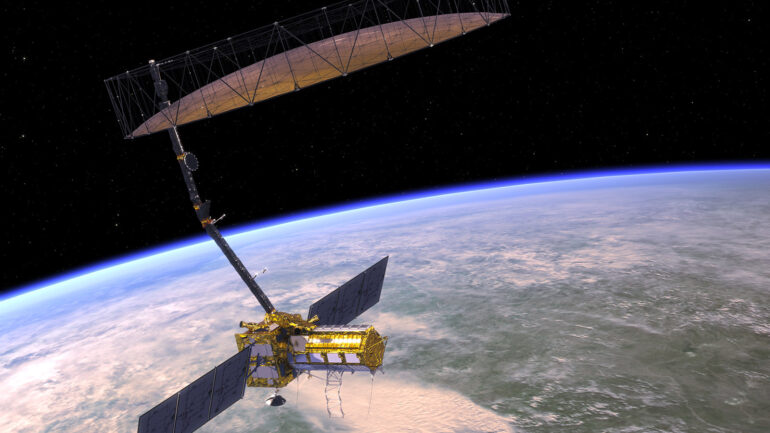

NASA and the Indian Space Research Organization (ISRO) are set to launch a groundbreaking Earth-mapping satellite, NISAR, which will use dual frequencies to map the Earth’s crust in extreme detail. The satellite, which will cost an estimated $1.5 billion, will be the first of its kind to use both the L and S microwave bands in radar imaging, allowing for systematic observations of even subtle changes to the Earth’s crust, including earthquakes, tsunamis, and other natural disasters.
During a question and answer session held by NASA’s Jet Propulsion Laboratory on February 3rd, experts discussed the capabilities of NISAR, which is planned to operate for three years starting in early 2024. The satellite will provide worldwide coverage every 12 days, and the mission team hopes to make the data readily available to the public within one to two days. In emergency situations, the data can be delivered within hours.
See NISAR in @NASAJPL's clean room today at 5pm ET (2200 UTC). Set to launch from India in 2024, it will measure the movement of Earth’s surfaces to provide info on trends that affect global challenges like food security. https://t.co/6Hi8AyIQ1D
— NASA (@NASA) February 3, 2023
NISAR’s high-resolution data will not only help governments respond to and prepare for natural disasters, but also improve our understanding of climate change and threats to food security. The satellite’s time-based imagery and readily accessible data make it a valuable tool for scientists studying environmental changes.
With NISAR, scientists will have a spaceborne tool to study environmental changes at a very high resolution, providing a new level of insight into the Earth’s processes and natural disasters. The investment in this technology is expected to be well worth it, as the satellite’s data could have far-reaching impacts on our understanding of the planet and our ability to cope with its challenges.
