
No matter where you are, there must have been a time or there must be some aspirations right now, to travel the world. A few years ago, this process involved planning, booking tickets, and going on an adventure. But now, with the world fighting a pandemic, traveling has become a little more tricky and in some cases, a bigger hassle than anything else. Wouldn’t it be nice if there was some way to actually travel to your favorite place in the world, without really getting off your bed?
The first thought that may come to mind is Google Maps or Apple Maps. The map software has undergone so much evolution that you can now have a virtual tour of your favorite place, right inside your smartphone or PC, and the best part is, it doesn’t even cost a penny!!
But this mapping software has its limitations, and most of the time, the experience is not really as immersive as you may want it to be.
That is where the real solution comes into play, and that is none other than Google Earth.
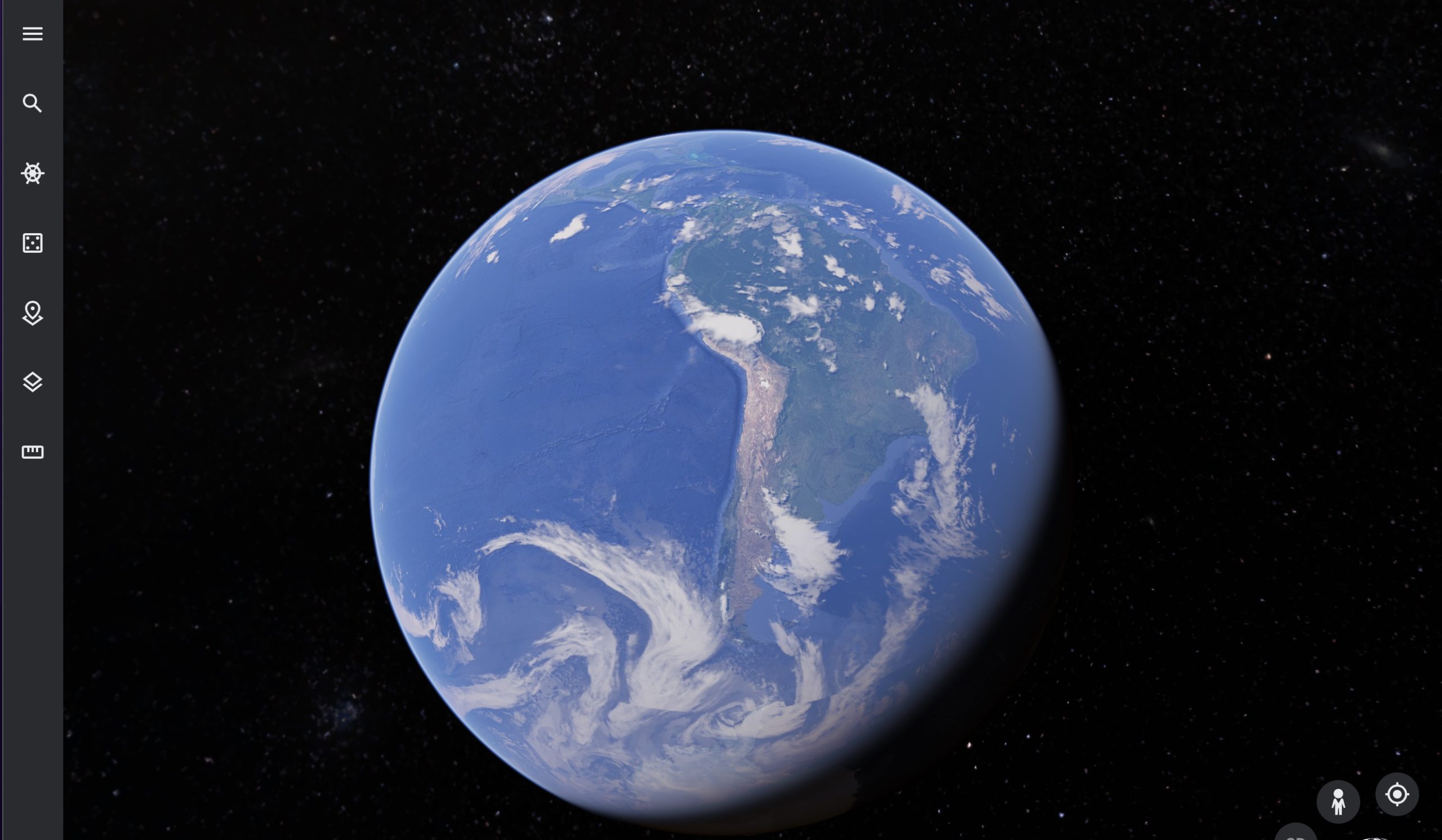
Google Earth, for those of you who don’t know, is the three-dimensional planetary browser that shows our entire planet (albeit a few top-secret military bases) in satellite imagery and aerial photos.
This has been in the works for a while now, and people have absolutely put this software on a different level, as it allows them to literally explore a virtual 3D earth, and all the places it contains, anytime and anywhere you want.
The software allows you to view some interesting data including current hurricane data. Now, before we show you how to get it done, please note that this data is just approximate and is updated every 30 minutes. In no way is this data meant to be taken as gospel. With the disclaimer out of the way, let’s take a look at how you can view the current Hurricane status –
Step 1. Open the web version of Google Earth on your computer web browser.
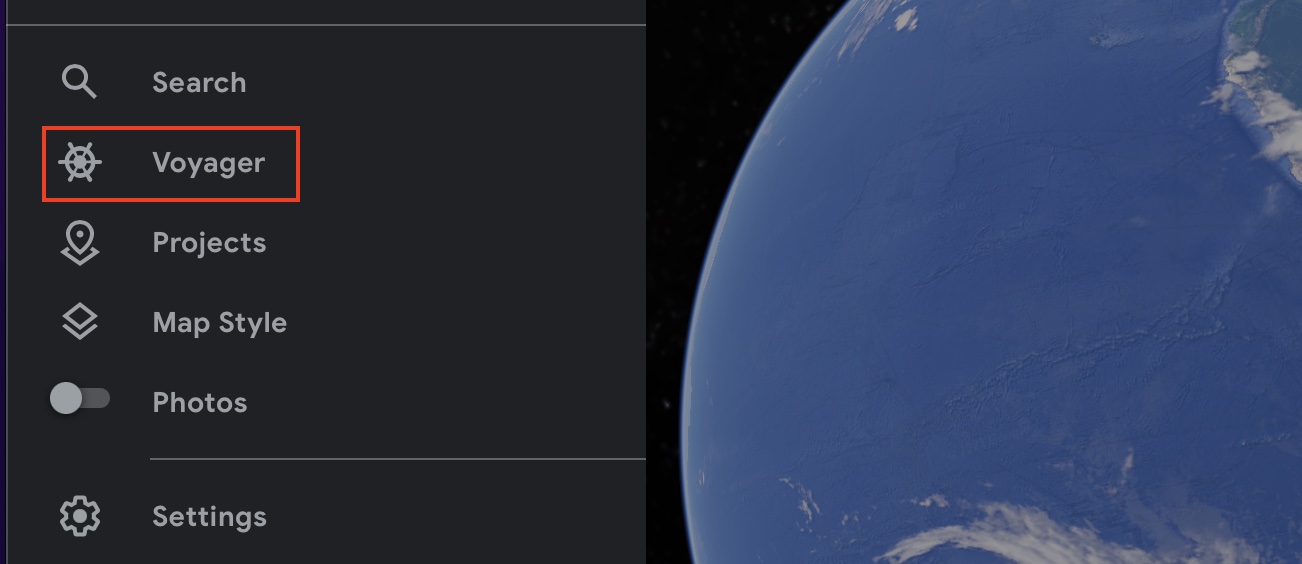
Step 2. Click on the ‘Voyager’ button on the left-hand side toolbar.
Step 3. Now, scroll through the voyager menu and click on the ‘Current Hurricanes and Tropical Storms’ option.
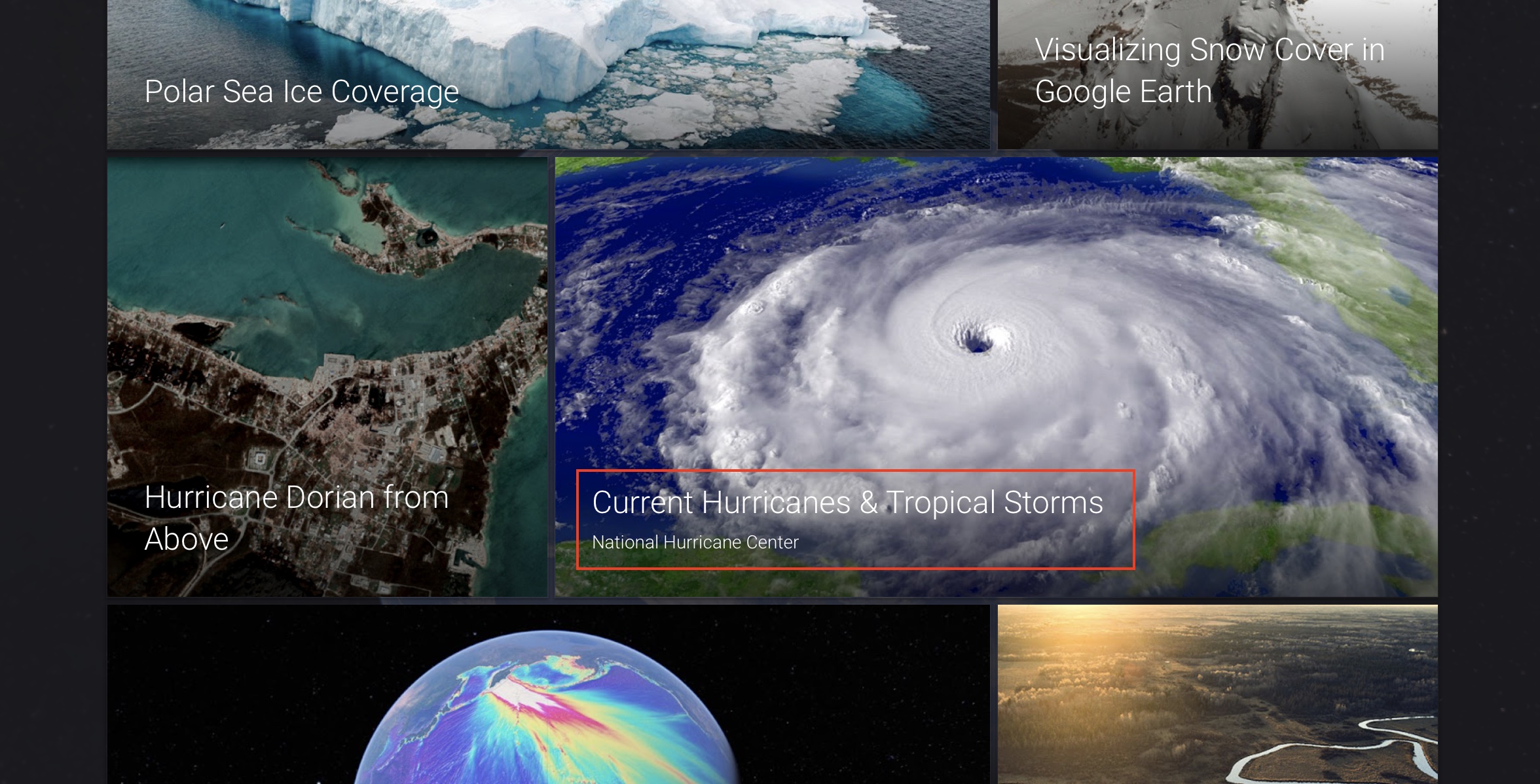
You will now see an approximate tracking of hurricanes ongoing around the world. You will also see a legend that will explain the symbols you may see on the screen.
You can download and run Google Earth on your system using this link.
So, go ahead, explore the world, without getting off your sofa!!
